


 다운로드 TOP50
 PC 카테고리
 자유게시판
자유게시판
i-Boating:
 다운로드수 62
-
4 (0명)
| 분류 | 내비게이션 |
|---|---|
| 버전 | 버전 152.0.0 |
| 업데이트 | 2024년 12월 18일 |
| 용량 | 50.8MB |
| 앱결제 | 무료 |
| OS | iPhone: iOS 12.0 이상 필요 / iPad: iPadOS 12.0 이상 필요 / |
| 디자인 | iPad용으로 디자인됨 |
| 금주 다운수 | 1 |
| 누적 다운수 | 62 |
| 다운로드 | |
|
!소프트웨어 사용범위 위반 시
법적 책임을 질 수 있습니다. |
|


상세정보
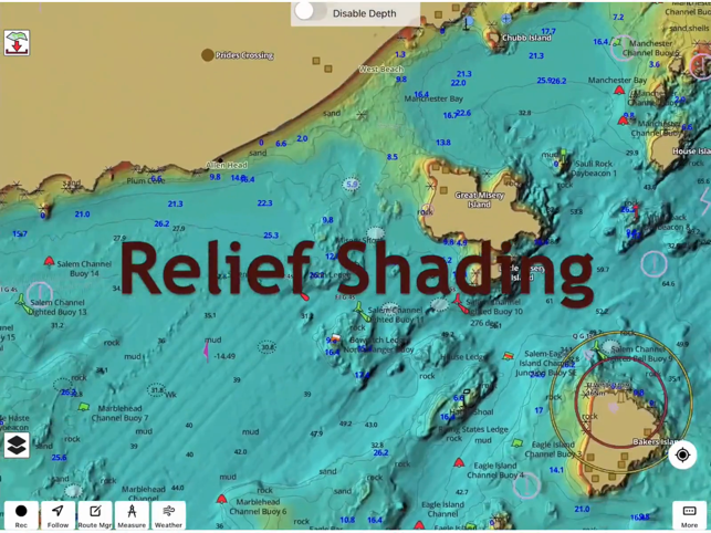
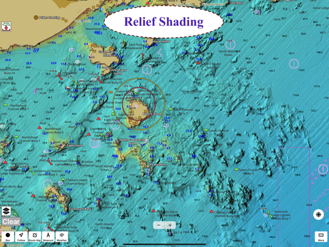
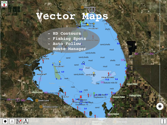
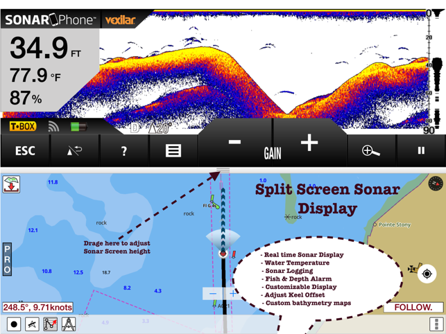
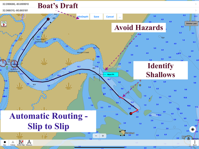
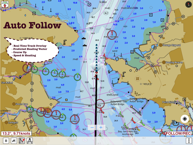
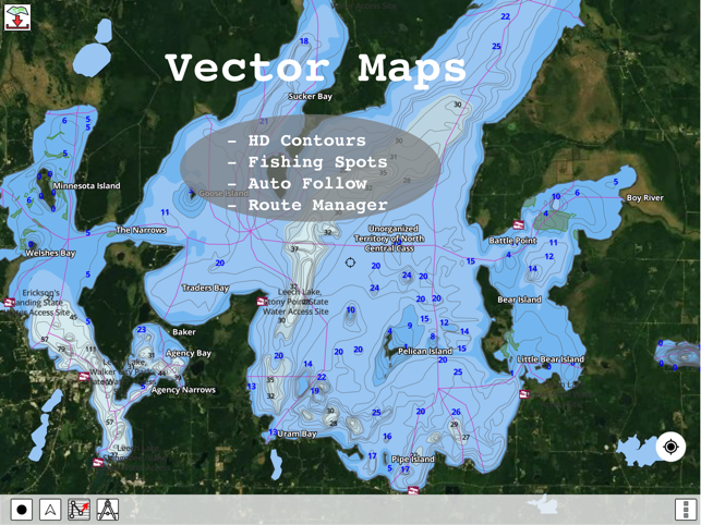
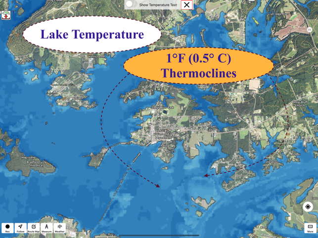
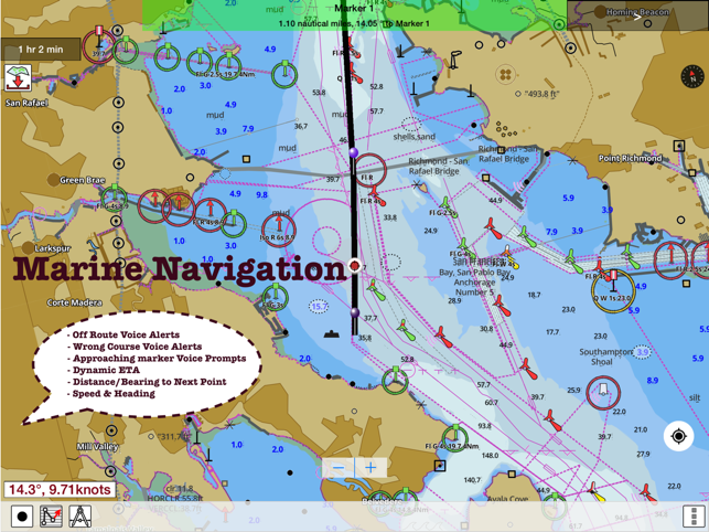
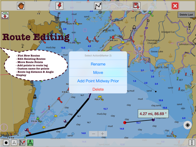
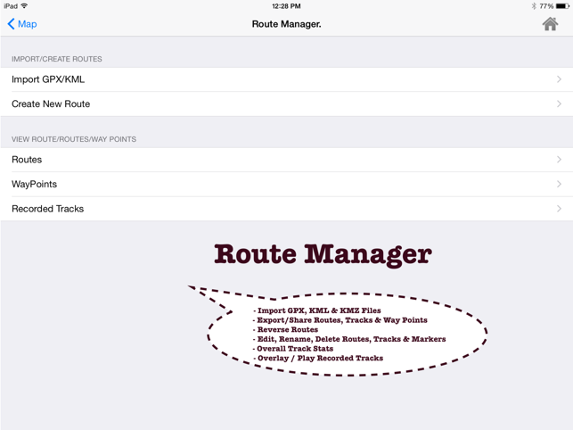
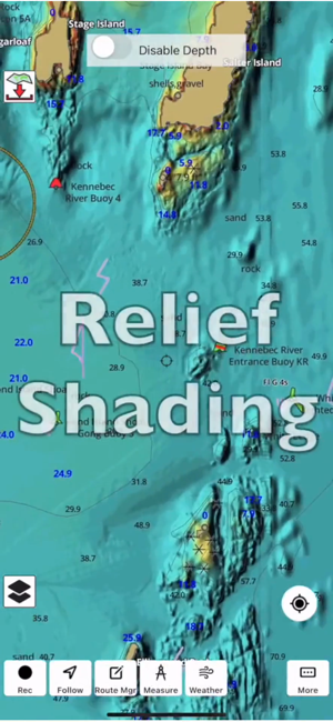
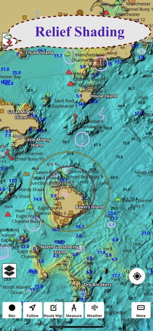
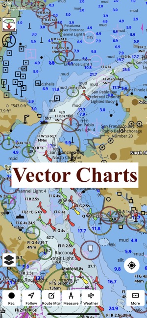
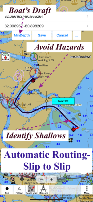
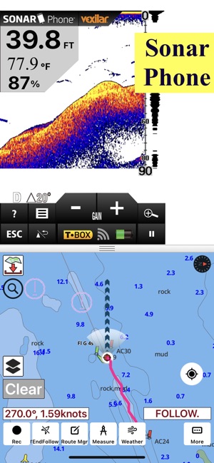
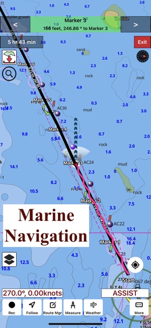
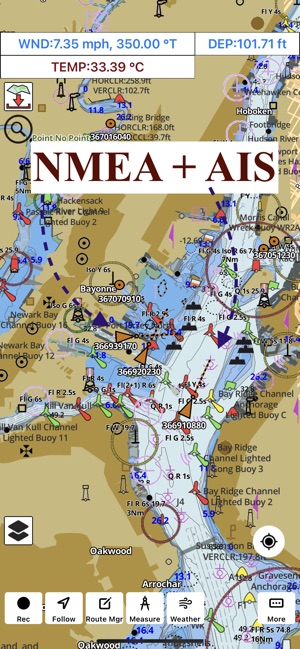
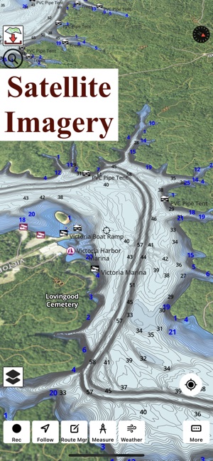
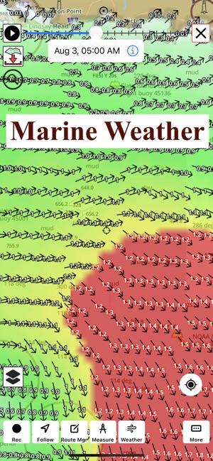
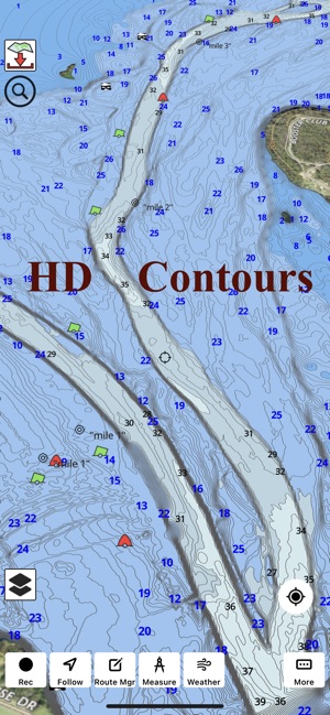
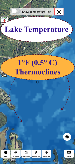
This App offers access to Marine Charts for USA,Canada,UK/Ireland,Germany,Netherlands/Holland &Europe Rivers (Danube,Drava,Rhein etc). Coverage includes NOAA marine vectorcharts,freshwater lake maps,USACE inland river maps (HD/1ft/3ft bathymetryincluded where available),charts derived from UKHO & CHS data. First marine GPS app to have route assistance with Voice Prompts for marine navigation. You can create new boating routes or import existing GPX/KML routes. It supports Nautical Charts course up orientation. Includes Tide & Currents prediction.►FEATURES√ Beautiful & detailed Hardware/GPU accelerated vector charts (text stays upright on rotation)√ Long press to query the details of Marine object (Buoy,Lights,Obstruction etc).√ Customizable depth(Ft/Fathom/Meter) & distance units(km/mi/NM)√ Customizable Shallow Depth.√ Record tracks,Autofollow with real-time track overlay & predicted path vector.√ Voice Prompts for marine navigation (requires GPS )√ 1ft / 3ft d
새로운 기능
- In time for Christmas, Lake map updates for Ice Fishing- New lake depth maps covering UK (Rutland waters, Grafham etc)- Compiled with latest version of Xcode
저작권
© 2013 Bist LLC
리뷰
- 소프트쉐어 신규 소프트웨어 추가 안내 2025.01.17
- 소프트쉐어 서비스 이용 가이드 업데이트 안내 2025.01.17
- 소프트쉐어 웹사이트 리뉴얼 안내 2025.01.17


