


 다운로드 TOP50
 PC 카테고리
 자유게시판
자유게시판
Australia Topo Maps
 다운로드수 129,911
-
0 (0명)
| 분류 | 지도/내비게이션 |
|---|---|
| 버전 | 7.6.0 |
| 연령 | 3세 이상 |
| 업데이트 | 2016. 4. 20. |
| 금주 다운수 | 0 |
| 누적 다운수 | 129,911 |
| 개발사 | ATLOGIS Geoinformatics GmbH & Co. KG |
| 다운로드 | |
|
!소프트웨어 사용범위 위반 시
법적 책임을 질 수 있습니다. |
|


상세정보
Easy to use Outdoor/Offline GPS navigation app with access to the best topographic maps and satellite images for Australia
For offline use PRO features needed
Turn your Andoid Phone/Tablet into an outdoor GPS for trips into the backcountry WITHOUT CELL COVERAGE This app gives you similar mapping options as you might know from Garmin or Magellan GPS handhelds
Included FREE map layers
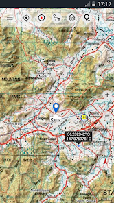
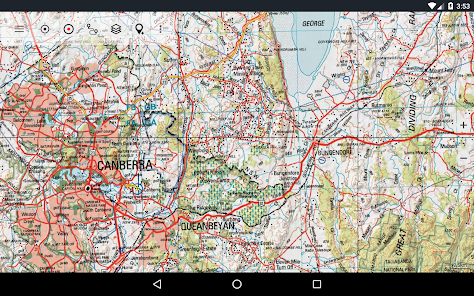
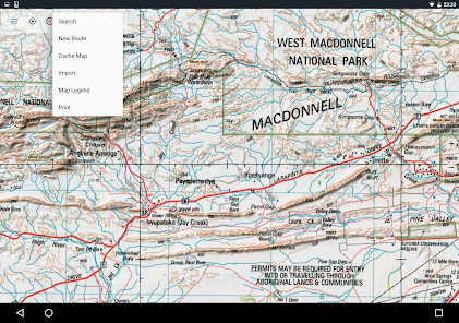
NATMAP 1250000 Topo Maps latest edition enriched with hillshading and additional placenames
Getlost Maps topographic and touring maps for complete Australia in 175000 and 1250000 Victoria amp East NSW in 125000
Australia Base Map Seamless national dataset for whole of Australia Very detailed
Queensland Topo Maps HiRes topographic maps
New South Wales Maps HiRes topographic maps scanned raster amp digital HiRes Imagery
South Australia HiRes topographic maps amp Street Maps
Tasmania Maps HiRes topographic maps HiRes Imagery
Northern Territory Atlas
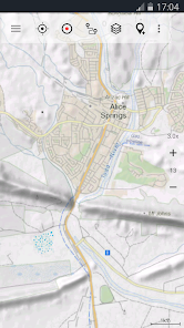
OpenStreetMaps These crowdsourced maps are a very useful addition to other map layers Contains many unique features
OpenCycleMaps These maps are ideal to plan bicycle trips
Geological Map for biologists geologists miners
ESRI Topographic
ESRI Aerial Images
ESRI Street Map
Google Road Map online access only
Google Satellite Images online access only
Google Terrain Map online access only
Bing Road Map online access only
Bing Satellite Images online access only
Earth At Night
Hillshading and contourlines 20m overlay worldwide
Transport/Infrastructure overlay
Premium Map layers
Victoria 125000
For only 7899 AUD you get unlimited access to all 25k Vic topo map sheets 865 maps stitched together to a seamless mosaik complete coverage Easy to download and offline use Single GeoPDF map sheets cost 85 at Vic DELWP office
Western Australia 125000 1100000
For only 15499 AUD you get unlimited access to all available 25k50k and 100k WA topo map sheets 3044 maps stitched together to a seamless mosaik Easy to download and offline use Single GeoPDF map sheets cost 126 at WA Landgate office
Main features for outdoornavigation
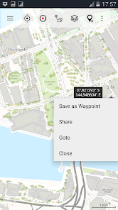
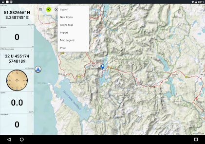
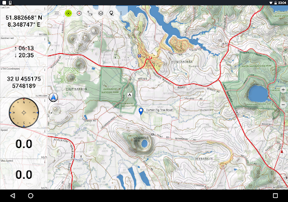
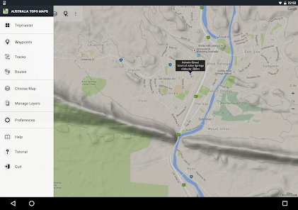
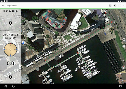
Create and edit Waypoints
GoToWaypointNavigation
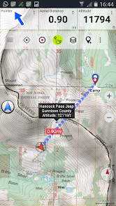
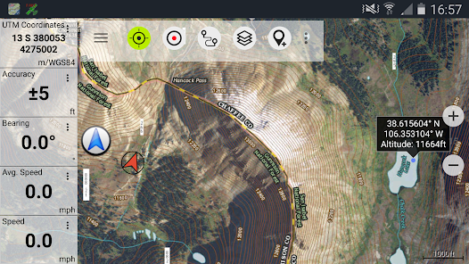
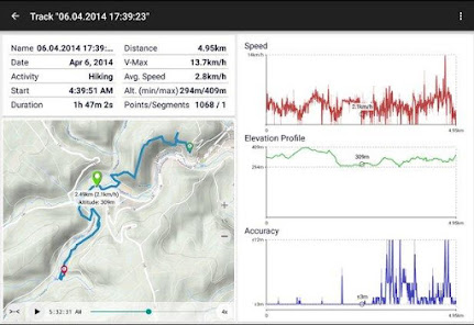
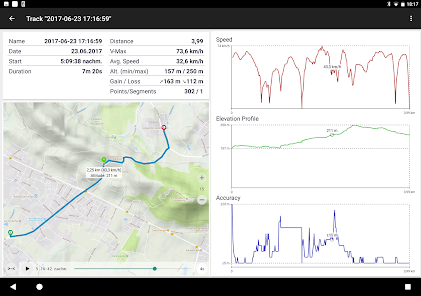
Track Recording with speed elevation and accuracy profile
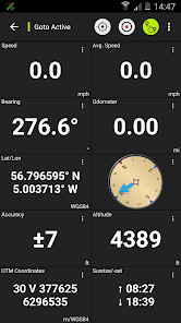
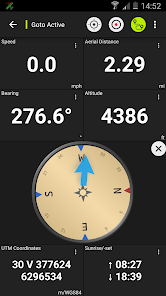
Tripmaster with fields for odometer average speed bearing elevation etc
GPX/KML/KMZ Export
Search placenames POIs streets
Customizable datafields in Map View and Tripmaster eg Speed Distance Compass
Share Waypoints Tracks or Routes via eMail Whatsapp Dropbox Facebook
Display coordinates in Lat/Lon UTM or MGRS/USNG Military Grid/ US National Grid
Record amp share tracks with statistics amp elevation profile
Rotate map Track Up amp North Up
Get Elevation by long click on map
Track Replay
and many more
Available Pro features Pro features available via In App Purchase
Offline Use no cell coverage needed No Roaming fees
EasyFast Bulkdownload of map tiles for OFFLINE USAGE not for Google and Bing maps
Create and edit Routes
RouteNavigation PointtoPoint Navigation
GPX/KML/KMZ Import
unlimited Waypoints amp Tracks
Add other Map TileServer
No Ads
Offline Use
All viewed map tiles are kept in cache To cache large areas you need to purchase Pro features
Use this navigation app for outdoor activities like hiking biking camping climbing riding skiing canoeing hunting offroad 4WD tours or searchamprescue SAR
Add custom waypoints in longitude/latitude UTM or MGRS/USNG format with WGS84 datum
Import/Export/Share GPSWaypoints/Tracks/Routes in GPX or Google Earth KML/KMZ format
Preload FREE map data for areas without cell service Pro feature
Comments and feature requests to infoatlogiscom
We DO NOT track any user activities or collect any user data
리뷰
- 소프트쉐어 신규 소프트웨어 추가 안내 2025.01.17
- 소프트쉐어 서비스 이용 가이드 업데이트 안내 2025.01.17
- 소프트쉐어 웹사이트 리뉴얼 안내 2025.01.17


